Pages

Saturday, August 20, 2011

Canada - Montana - and now HOME!

Canada - Montana - North Dakota - and HOME!

We have heard many people tell us that the Canadian Rockies were beautiful and we discovered that they were absolutely right! After crossing the border and driving only a few miles into Canada, we found ourselves driving right down a valley, surrounded by mountains on all sides.  Our first real glimpse was at a roadside stop overlooking Columbia Lake.


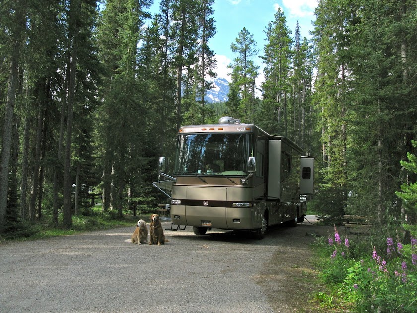
The Lake Louise Campground in Banff National Park is actually two campgrounds, one for tents and one for hard-sided campers. Since the Lake Louise area is home to many grizzly bears the tent area is surrounded by an electric fence to protect both the bears and the campers.

The information flyer they gave us when we checked into the hard-sided section mentioned that since the bears can’t pass through the tent area, they often cut through the RV area!  We were cautioned to keep everything inside the RV, to not go out after dark and to make sure Abbey & Jameson did not go poking their noses into any bushes!  On our first three days in the campground, we took Abbey & Jameson on a beautiful hiking trail that followed the Bow River. Jameson spent some time fishing but the water was too cold for an extended effort. On our last day here Jameson was very disappointed as the trail was closed due to “bear traffic”. We are happy to report that we had no bear encounters during our stay.
Jameson Fishing in the Bow River


Due to the extreme amount of snow the area received this winter, there was still a lot of snow on the mountain tops and a lot of glacial run-off still pouring into Lake Louise.  The water carries sediment down the mountain which they refer to as “glacial flour” and it made the water a little cloudy. Usually by August, the snow is gone and the sediment has settled to the bottom making the water a deeper turquoise blue.  It was still very impressive and beautiful.
Lake Louise


Other than the seeing the lake, there is not much going on in Lake Louise. There is a small Village Center with a few shops and restaurants (mostly expensive!) and condos and cabins for tourists.  At the northern edge of the lake is the famous Fairmont Chateau Lake Louise, a hotel with rates as high as $2,000. per night!  We strolled through the Lobby and shops and pretended that we were registered guests and were entertained by a bagpipe band. The band was on a summer tour and its members represented the best players from each of the Canadian Provinces.


We took a drive to see Moraine Lake, just 14km (8.4 miles) away from its more famous neighbor and it was even more impressive than Lake Louise. Even though there was still lots of snow on the surrounding mountains, the water here was a much deeper turquoise blue. It is still hard to really capture the color in photos.


Tom’s knees were feeling pretty good so we climbed up the trail to the overlook. It was worth the hike as we got a great view of the lake and the mountains. Moraine Lake is nestled in the Valley of Ten Peaks but it was impossible to get a photo of all 10 peaks!

 After taking more than enough photos, we just sat there for awhile and soaked in the sun and the view.


They told us the safest way to see a grizzly bear was to take a ride on the Sightseeing Gondola from the Lake Louise Ski Area.  The chairlift rises over the grizzly habitat to the top of Mt. Whitehorn at an elevation of 6,850 feet.

From our open chair we saw one grizzly enjoying a sunny afternoon on the hillside below us.  At the top we took in panoramic views of Lake Louise and the surrounding mountains.


We spent just one afternoon wandering around in the town of Banff. It is a cute all-season tourist town with the usual shops, restaurants and condos but we were happy that we had picked a campground closer to Lake Louise.

Due to the increase in the number of people visiting the Lake Louise and Banff area over the years, there has also been an increase in the traffic on the Trans-Canadian highway and a resulting increase in the number of bears and other animals killed on the highway.  In an effort to keep the wild life from wandering onto the roadways, high fences and dedicated overpasses and tunnels have been constructed for the animals to cross the road.

They have motion activated cameras on the crossings and they have captured over 220,000 photos of bear, elk, cougars and deer using the crossings since 1996.  They said that it can take up to 5 years for bears and wolves to adapt to using the cross-overs, but the elk and deer were using them while they were still under construction.

If we didn’t capture the beauty of this area, it wasn’t for lack of trying!  We took 404 photos in just over 3 days!

Our next journey was to travel the 140 mile Icefields Parkway between Lake Louise and Jasper. This road traces the Continental Divide and offers spectacular views of the many glaciers, rugged peaks and turquoise lakes all along the way.  There were not too many pull-outs that would accommodate our 40 foot RV towing the Jeep, but we did get to make a few stops on our trip.


Jasper is another small town with many year-round visitors. We stayed in the Whistler Campground in Jasper National Park but since we had not planned too far ahead, we could only get a no-hookup site. It was a little more rustic and not as scenic as the Lake Louise Campground but it was fine for our short 3 day stay. We did see lots of elk in the campground.


We took a few side trips, the most impressive being a trip to see Athabasca Falls and the Angel Glacier.

Flowing from the Columbia Icefields the waters of the Athabasca River rush through a narrow canyon creating the Falls. As we stood on one of the cross-over bridges we could feel the vibration of the water thundering below us.


Following a switchback road up the mountainside, we took a short hike to the base of Angel Glacier on Mt. Edith Cavell, named in honor of an army nurse who was a WW I heroine. The glacier is supposed to look like an angel with wings on each side. It takes a little imagination.


We had a much sunnier day on our return trip down the Icefields parkway and made a few more photo stops along the way.
Columbia Icefields


After stopping at one lookout we hit a huge pothole as we re-entered the highway. The cabinet doors flew open and dishes and food went flying! Luckily we only lost one soup bowl and the butter dish, and there was another pullout just a short distance away so we could recover!

Our last night in Canada we found a casino with free overnight parking in Canmore, Alberta.   Although Canada is certainly beautiful, we found out it is not cheap. Including fuel, camping fees and a couple of restaurant dinners, this was the most expensive 9 days of our trip so far! 

After safely crossing the border back into the US, our next stop was St. Mary’s, Montana to visit Glacier. National Park. We had been to Glacier on our 2008 trip, but this year we visited two new sections of the park. We traveled back into Canada to see the Waterton Lakes area an also drove through the Many Glacier section.

In Waterton there is a little village with about 100 year round residents. Once again it was mostly shops and restaurants so we did not stay long.


We took two of the scenic drives and a couple of short hikes to see Red Rock Canyon and Cameron Lake. Most of Cameron Lake is in Canada but the southern tip of the lake is in the US.
Red Rock Canyon
Cameron Lake-Looking at the US side

We also saw some bears along the road!


If you are visiting Glacier you have to drive the Going To The Sun Road. We only drove as far as Logan Pass as we had made this trip before in 08 and there was more road construction going on on the west side of the pass.  They had record amounts of snow this year and at Logan Pass there was still a lot of snow on the trails.

The road did not even open this year until July 13th!  We hiked up to the overloook but the rest of the trail was still snow covered. The snow did not seem to bother this mountain goat!


We tried part of it, but it was steep and slippery so we gave up and went back down. We saw several snowboarders trying their skill on the slopes,  most were not ready for the Olympics but they were having fun.
Snowboarders on Glacier


From Glacier we traveled 400 miles across the state of Montana to Wolf Point. We camped at the Elks and enjoyed a great steak dinner at the Lodge. The next morning we traveled 50 miles north to visit Scobey, MT.  This is small town where my Mom grew up and we still have a small ranch there  (Although there is no such thing as a SMALL ranch in Montana). There is not much going on in Scobey but  it is beautiful country!  This year the senior class at the high school has 13 graduates. 
Downtown Scobey

MOM'S  RANCH

There were not many restaurants but we had a nice dinner at the Silver Slipper and breakfast at the Outlaw Trail Cafe. 


We also visited the Pioneer Museum where they have restored many of the old buildings from the early pioneer days. My grandfather used to own the Bank!
Pioneer Museum

In Granddaddy's Bank with Edgar (Mom's childhood friend)


Our next stop was Teddy Roosevelt National Park in Medora, North Dakota. We had also been here once before but we had more time to explore the Park on this trip. We saw bison, elk, feral horses and lots of prairie dogs.


Jameson found the prairie dogs to be very entertaining as they would appear and dissapear running in and out of their holes.


 On this trip after spending the day at the Park, we treated ourselves to a special night out at the famous “Pitchfork Steak Fondue and Medora Musical”.  The steak was a little well done but still pretty tasty and the show presented in an outdoor amphitheater was very entertaining.


So now we have arrived in Box Elder, South Dakota, our official “Home”.


 We stopped here to get our driver’s licenses changed to our current address, but while we were here we made a few quick trips to see Mt. Rushmore, Crazy Horse Monument, Wall Drug and the Badlands National Park.

In just a short walk through the parking lots, we counted license plates from 21 different states at Mt. Rushmore. Wall Drug came in second place with 20 states represented. One took years of hard labor and was created to honor four of our Presidents and the other started with a sign offering a free drink of cold water for travelers. They both draw a lot of tourists!

From here we will travel to Minnesota for September and then on to Massachusetts for October where we are expecting a new grandson on Halloween!


This will be the last Blog for a while as the next few months will be spent relaxing and visiting family and friends.  We hope to see many of you very soon.

LOTS MORE PHOTOS


Monday, August 1, 2011

Washington & Idaho

WASHINGTON & IDAHO

Our first stop in Washington was just across the Columbia River from Oregon in Ilwaco, WA.   This is the area where the Columbia River meets the Pacific Ocean and is considered to have some of the most turbulent waters in the world, earning its name “The Graveyard of the Pacific”. It is responsible for the loss of over 2,000 ships and many lives since the late 1700‘s.  We didn’t stay long but we did take time to visit the Cape Disappointment Lighthouse in Desperation Point State Park.
 

Our first stop as we traveled north was at the Rainforest Village RV Resort in Quinault, WA.It was not really a “resort”, but ended up being one of our favorite places so far. We had a beautiful site overlooking Lake Quinault. Abbey & Jameson had a great time in the lake, Abbey swimming and Jameson fishing!.

Our site was also just a stones throw from the World’s Largest Spruce Tree. Although it was impressive at 191 feet tall, after our visits to the Redwoods and Sequoias it was just another big tree!


The entire lake area is managed by the Quileute Tribe. There was also a big lodge where Franklin Roosevelt once stayed and a restaurant. If you stop by here, skip the restaurant. We had really bad breakfast there, cold coffee, burnt toast and hashbrowns that resemble left over french fries from last night’s dinner menu.
The next day we took the Jeep and drove to Olympic National Park to see the Hoh Rainforest, one of the last old-growth temperate rain forests in the western hemisphere. On the way we passed several signs pointing to turnoffs to see “The Largest Douglas Fir, The Largest Yellow Cedar and the Largest Western Hemlock”, but we had seen enough big trees for this trip.


The HOH Rainforest gets an average of 14 feet, not inches, of rain a year! We hiked the two trails through the forest,The Hall of Mosses and another trail along the river. Before returning to our lakeside home we drove a few miles further north to Forks and had lunch at a small cafe. Many of the stores in town sell stuff related to Twilight . I guess The Forks High School was used in filming the movies.


The next day back at the campground, we found another trail to explore the Quinault Rainforest. It was a nice day and we decided the exercise would be good for us. Upon returning to the car after our 2.5 mile hike we discovered that Tom had dropped the car keys somewhere along the route. We hoped another hiker had found them and turned them into the Ranger Station. Unfortunately, the Ranger Station had closed for the day. We did have a spare back in the RV, so I started walking the 2 mile trip back to get it. I got lucky as a woman stopped and gave me a ride most of the way back. As I started my return trip back to the Jeep, Tom came drivng around the bend. Someone had found the keys and turned them into the Ranger Station and the cleaning crew showed up and let him in to check for the keys. I guess it was our lucky day!

The next day we continued up the coast traveling around the northwest side of Olympic National Park to Sequim, WA.  We noted an important moment in our journey!  On July 8, 2011 at 12:23 PM  (Pacific Time) we made our first turn EAST since we left Massachusetts on July 15, 2010. In just 7 days short of a year, we have put 8,162 miles on our rolling home.

Olympic National Park, we discovered,  is one of the most diverse parks as it includes glacier capped mountains,  temperate rain forests, meadows, lakes and miles of beaches. On our way to Sequim we drove by Crescent Lake a 12 mile long, 624 foot deep crystal clear lake carved long ago by a glacier.  People say that no matter how many times they visit the Olympic Peninsula, they never tire of seeing the turquoise blue waters of the lake.


Arriving in Sequim we pulled into the Elks Lodge. We had a great view of the Olympic mountains from our campsite.

Squim, we discovered, is host to a huge Lavender Festival and has over 30 local lavender farms growing over 100 kinds of lavender. Some call it the Lavender Capitol of North America as there is something about the climate that is very amenable to growing lavender. We arrived a week too early for the Festival but we were able visit a few of the farms.


We also drove through the Dungeness Recreation Area to see the Lighthouse. We had to take a photo from a distance as it was a 5.5 mile walk on sand to get to it. It is said to be the longest natural sand spit in the nation. The Lighthouse is actually only about 4 miles out as the spit continued to develop after it was  built.


Sequim is also home to over 100 Roosevelt Elk. Many have been tagged with radio transmitting devices that will change the traffic lights on the busy 101 highway if they are close to crossing.


One day we drove the 19 mile road up to the Hurricane Ridge Visitor Center which got its name from the 75 mile an hour winds that often buffet the ridge. It was a one of the few sunny days that we had so we enjoyed spectacular views of the Olympic Mountain Range and took a short hike on one of the trails at the top.


The next day we went to Port Angeles and took the ferry to Victoria, Canada, This was a 90 minute, 22 mile trip across the Straits of Juan de Fuca. It was a fairly smooth ride which was good since they had a sign near the life boats with information about the 1-10-1 Principle

Caution - Water is VERY COLD!  If you go over, it will take you 1 minute to catch your breath, 10 minutes until your limbs go numb and  you will not be able to hold on or tread water,  and 1 hour until hypothermia leaves you unconscious.

We made it safely to our destination and spent the afternoon walking around the inner harbor enjoying the street performers and local artists selling their crafts. There were more shops than restaurants but after a bit of a walk we found a cafe for lunch and then walked around the historic downtown area with more shops, galleries and the historic Epmpress Hotel. We did not have time to visit the famous Butchart Gardens but will put in our list for our next visit.


On our last day in Sequim, we drove to Port Townsend, a Victorian seaport town which is now on the National Register of Historic Places. Located at the northern end of Puget Sound, Port Townsend is also home to Fort Worden, a military base commissioned in 1902.  The Fort is now a 434 acre state park where they filmed the movie An Officer and a Gentleman.


Our next stop was in Randle, WA. a good stop to visit Mt. St. Helen’s and Mt. Rainier.

Mt. St. Helen’s eruption in May 1980 was caused by a 5.1 magnitude earthquake and ended up killing 57 people and devastating the area for miles round. From October 2004 through January, 2008 there were ongoing ‘minor’ eruptions that produced over 125 million cubic meters of lava, enough to pave a three-foot thick, seven lane highway from Portland, OR to New York City!  Thirty years later as we drove to the mountain we could still see the downed trees and barren, gray landscape. It was nice to also see that there are some signs of revival with new trees and flowers sprouting up. Weyerhaeuser, a huge lumber company, replanted 18,400,000 trees, by hand, over a 4 year period!

The Johnson Ridge Observatory is named after one of the geologists killed in the eruption. He was observing and recording the activity and thought he would be protected by the ridge. The Visitor Center had many informative exhibits, stories of survivors and presented a wide screen movie about the dramatic blast. At the end of the movie, the curtains opened up to supposedly reveal a magnificent view of the crater and the lava dome. Unfortunately it was very overcast during our visit and when the curtains opened, all we could see was a gray mist covering most of the mountain. 
This is what we were supposed to see.

Oh well....we’ll come back again on our next trip out west.

The day we visited Mt. Rainier was better and we had mostly sunny skies. We could see almost all of the mountain. There was a small cloud that seemed to just hang over the peak and never move.  They say, Mt. Rainier creates it’s own weather system and most visitors have to come back several times to see the top!

It was a beautiful drive up and back with many scenic overlooks. The road that goes through the park just opened and there is still up to 10 feet  of snow on the ground in some places.


We decided to move on in search of better weather. We traveled up over the Cascade Mountains through White’s Pass to Moses Lake, WA.where there was one of our membership parks so we could stay for $1.20/ day (full-hookups!) It ended up being a nice campground right on the lake.  Abbey & Jameson got a chance to relax and swim in the lake for a few days. We met a couple who live near Randle and they said they often come over the mountain on weekends to find some sunshine and warmer weather. It was nice to just hang out for a few days and not go sightseeing for a change!

Everyone said we had to see Coeur D Alene, Idaho as it was a really beautiful area. We had not really planned our route too far ahead and we needed to spend at least one night in Idaho if we wanted to fill it in on our big map.  They had an Elks Lodge with an RV Park so we decided to give it a try. That ended up being an excellent decision.  We have discovered that Idaho, at least northern Idaho, is a really beautiful area.It has a little bit of everything, lakes, mountains and prairies.

In Coeur D Alene we spent a couple of days checking out the local shops and restaurants and had dinner at one of the many lakeside restaurants.


From there we drove 30 miles north to Blanchard, ID. because we had a coupon for a free 7 night stay at a Golf & RV Resort . Of course they wanted to give us their sales pitch about buying an RV lot or a condo, but we have done several of these and know how to say NO THANKS!  At first we thought we would only stay 3 or 4 days but we liked it so much we stayed for the whole week and would like to come back next year. It is a beautiful place with a great golf course and friendly people. They also had a great dog park for Abbey & Jameson. The prices were right and we were tempted but the time is not right for us to buy anything right now!


Blanchard is a little “out-of-the -way” but it is beautiful country with views of lakes and mountains in all directions.  We did take a couple of day trips. One to Green Bluff an area with over 40 family owned farms and wineries each selling local products. Many also have small restaurants for lunch and Country Store style gift shops. In addition to the usual fruits and vegetables their was an Alpaca Farm and several Chritmas Tree farms.  It was a fun place to spend the day. We stopped at one Italian winery that also sold freshly made meatballs and minestroni soup so we took some home and enjoyed an excellent dinner.

On another day we took a drive to Sandpoint, a big recreation area about 40 miles north of Blanchard. There is a big lake there bringing lots of summer visitors but there is also a ski area just a little north so it really is an all-season vacation area. We had lunch at a great lakeside restaurant and checked out a couple of RV parks. We decided that our place in Blanchard was much nicer!


Our last stop in Idaho was in Bonners Ferry, just 20 miles from the Canadian border. It is a very small town and home to several Indian tribes. In 1974, after years of mistreatment by the American government, one of the tribes declared war on the United States. They said they are still working out an agreement. On our last day in Idaho, we went to the top of the Schweitzer Ski area to enjoy the view.


As I have said before, we are really enjoying our Gypsy lifestyle.  In April we started up the coast highway from San Diego and except for two diversions around Los Angeles and San Francisco, we have traveled over 1300 miles up the coast highway through California, Oregon and Washington.  We are really understanding the meaning of one of our favorite sayings: Life’s A Journey, Not a Destination!”
As you can see from our map, we are making progress and have only five states to go in the continental US.


See you down the road.

PS.    Our newest bumper sticker:  Be Kind To Animals....Kiss an ELK!

MORE PHOTOS